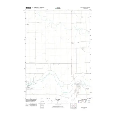
2010 Map of Sioux Rapids
USGS Topo · Published 2010About this map
The Little Sioux River meanders through this portion of Northwest Iowa, defining the local geography as it flows past Sioux Rapids and Linn Grove. This 2010 survey reflects a landscape shaped by both the winding river valley and the rigid precision of the rural road grid. The map is particularly valuable for genealogical research, documenting several burial grounds including Liberty Cemetery in the north and Saint Josephs Cemetery to the southeast.
Find a feature on this map
46 named features on this map. Tap any name to fly to it.
Don’t see what you’re looking for? This feature index may not catch every label — zoom into the map to look around manually.
Map Details
Editions of this 2010 Sioux Rapids Map
This is the sole edition of this map. No revisions or reprints were ever made.
Other maps of this area

1954 · Fairmont
USGS Topo · 1:250,000

1954 · Fort Dodge
USGS Topo · 1:250,000

1957 · Fort Dodge
USGS Topo · 1:250,000

1958 · Fort Dodge
USGS Topo · 1:250,000

1958 · Fairmont
USGS Topo · 1:250,000

1966 · Gillett Grove
USGS Topo · 1:24,000

1966 · Greenville
USGS Topo · 1:24,000

1970 · Royal
USGS Topo · 1:24,000

1971 · Sioux Rapids SE
USGS Topo · 1:24,000

1971 · Rembrandt
USGS Topo · 1:24,000