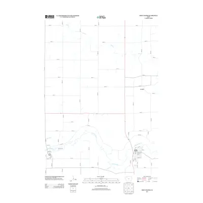
2013 Map of Sioux Rapids
USGS Topo · Published 2013About this map
Sioux Rapids and Linn Grove define the local landscape along the meandering path of the Little Sioux River in this 2013 survey. The river valley cuts through a grid of rural section roads, creating a distinct topographical contrast between the settlement areas and the surrounding agricultural uplands. Near Linn Grove, the Bluebird Access provides a recreational focal point where Bluebird Cr joins the main river channel. Further upstream, the small community of Cornell sits near the eastern edge of the quadrangle, connected to the larger centers by a network of numbered avenues and streets like 500th St and 200th Ave. Significant drainage features including Willow Cr and Soldier Cr illustrate the watershed patterns that have shaped the development of Buena Vista County, documenting the enduring footprint of these river-town settlements in the early 21st century.
Find a feature on this map
47 named features on this map. Tap any name to fly to it.
Don’t see what you’re looking for? This feature index may not catch every label — zoom into the map to look around manually.
Map Details
Editions of this 2013 Sioux Rapids Map
This is the sole edition of this map. No revisions or reprints were ever made.
Other maps of this area

1954 · Fairmont
USGS Topo · 1:250,000

1954 · Fort Dodge
USGS Topo · 1:250,000

1957 · Fort Dodge
USGS Topo · 1:250,000

1958 · Fort Dodge
USGS Topo · 1:250,000

1958 · Fairmont
USGS Topo · 1:250,000

1966 · Gillett Grove
USGS Topo · 1:24,000

1966 · Greenville
USGS Topo · 1:24,000

1970 · Royal
USGS Topo · 1:24,000

1971 · Sioux Rapids SE
USGS Topo · 1:24,000

1971 · Rembrandt
USGS Topo · 1:24,000