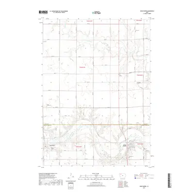
2018 Map of Sioux Rapids
USGS Topo · Published 2018About this map
The Little Sioux River carves a winding path through the borderlands of Clay and Buena Vista counties, anchoring the communities of Sioux Rapids and Linn Grove. This landscape is defined by the transition from upland agricultural plots to the alluvial valleys of Soldier Cr and Bluebird Cr. The distribution of rural landmarks indicates a deeply rooted local history, with several township and family-named cemeteries such as Fanny Fern Cem and Lone Tree Cem positioned near the river bluffs. In the north, the small settlement of Cornell sits among a rigid grid of country roads, including 450th ST and 460th ST, which segment the terrain into the townships of T95N and T94N. The concentration of features around Sioux Rapids on Main St and N River Rd highlights its role as a regional hub in this part of Northwest Iowa.
Find a feature on this map
44 named features on this map. Tap any name to fly to it.
Don’t see what you’re looking for? This feature index may not catch every label — zoom into the map to look around manually.
Map Details
Editions of this 2018 Sioux Rapids Map
This is the sole edition of this map. No revisions or reprints were ever made.
Other maps of this area

1954 · Fairmont
USGS Topo · 1:250,000

1954 · Fort Dodge
USGS Topo · 1:250,000

1957 · Fort Dodge
USGS Topo · 1:250,000

1958 · Fort Dodge
USGS Topo · 1:250,000

1958 · Fairmont
USGS Topo · 1:250,000

1966 · Gillett Grove
USGS Topo · 1:24,000

1966 · Greenville
USGS Topo · 1:24,000

1970 · Royal
USGS Topo · 1:24,000

1971 · Sioux Rapids SE
USGS Topo · 1:24,000

1971 · Rembrandt
USGS Topo · 1:24,000