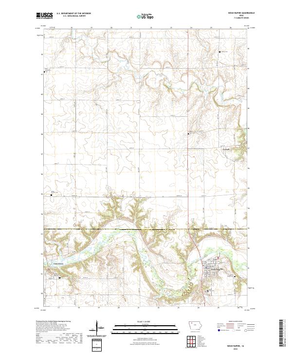
2022 Map of Sioux Rapids
USGS Topo · Published 2022About this map
Little Sioux River meanders across the southern landscape of this 2022 survey, anchoring the riverside settlements of Sioux Rapids and Linn Grove. This territory, spanning the border of Clay and Buena Vista counties, retains a traditional agrarian layout defined by a rigorous grid of section-line roads like 450th ST and 500th ST. Genealogists and local historians will find a high concentration of memorial sites, ranging from the Welsh Pioneer Cem to the Saint Joseph Cem, which document the denominational and ethnic heritage of the local farming community.
Find a feature on this map
43 named features on this map. Tap any name to fly to it.
Don’t see what you’re looking for? This feature index may not catch every label — zoom into the map to look around manually.
Map Details
Editions of this 2022 Sioux Rapids Map
This is the sole edition of this map. No revisions or reprints were ever made.
Other maps of this area

1954 · Fairmont
USGS Topo · 1:250,000

1954 · Fort Dodge
USGS Topo · 1:250,000

1957 · Fort Dodge
USGS Topo · 1:250,000

1958 · Fort Dodge
USGS Topo · 1:250,000

1958 · Fairmont
USGS Topo · 1:250,000

1966 · Gillett Grove
USGS Topo · 1:24,000

1966 · Greenville
USGS Topo · 1:24,000

1970 · Royal
USGS Topo · 1:24,000

1971 · Sioux Rapids SE
USGS Topo · 1:24,000

1971 · Rembrandt
USGS Topo · 1:24,000