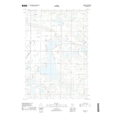
2018 Map of Siren East
USGS Topo · Published 2018About this map
Clam Lake and its intricate shoreline dominate this portion of Burnett County, where the Clam River weaves through a landscape defined by glacial hydrology. The area around Lower Clam Lake and Clam Lake shows a dense network of local roads and water bodies, including Mallard Slough and Sleighbell Slough. To the northwest, the village of Webster sits near the Gandy Dancer State Trail, a long-distance route following a former railroad corridor. To the southwest, the community of Siren is situated near Larson Lake and the Burnett County Airport. This survey provides a clear view of the transition between developed settlements and the numerous lakes that define northern Wisconsin, featuring important local landmarks like Clam-Lake Cem and Viola Lake Cem. Significant water features such as the Yellow River and Sand Lake further illustrate the water-dependent geography of the region.
Find a feature on this map
80 named features on this map. Tap any name to fly to it.
Don’t see what you’re looking for? This feature index may not catch every label — zoom into the map to look around manually.
Map Details
Editions of this 2018 Siren East Map
This is the sole edition of this map. No revisions or reprints were ever made.
Other maps of this area

1949 · Hertel
USGS Topo · 1:48,000

1950 · Webster
USGS Topo · 1:48,000

1951 · Cumberland
USGS Topo · 1:48,000

1951 · Frederic
USGS Topo · 1:48,000

1953 · Stillwater
USGS Topo · 1:250,000

1955 · Hertel
USGS Topo · 1:62,500

1955 · Webster
USGS Topo · 1:62,500

1955 · Frederic
USGS Topo · 1:62,500

1955 · Stillwater
USGS Topo · 1:250,000

1956 · Cumberland
USGS Topo · 1:62,500