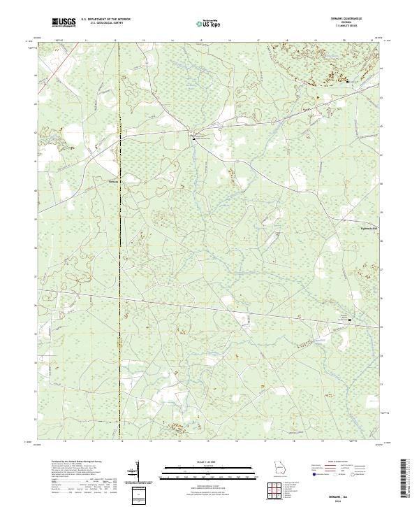
2024 Map of Sirmans
USGS Topo · Published 2024About this map
Suwannoochee Creek and its many tributaries, including Walker Creek and Camp Creek, dominate this South Georgia landscape along the border of Lanier and Clinch counties. The terrain is characterized by expansive wetlands and low-lying basins like Devils Bay, Whitehead Bay, and the sprawling Arabia Swamp in the northeast. These water features dictated the layout of rural life, with settlements like Sirmans and Eightmile Still situated at higher points or along established crossroads. Local genealogy is anchored by longtime community centers, specifically the Camp Creek Baptist Church Cem and Prospect Baptist Church Cem. The map illustrates a land largely defined by its natural drainage patterns and the network of county roads that navigate between the dense bays and pine flats.
Find a feature on this map
65 named features on this map. Tap any name to fly to it.
Don’t see what you’re looking for? This feature index may not catch every label — zoom into the map to look around manually.
Map Details
Editions of this 2024 Sirmans Map
This is the sole edition of this map. No revisions or reprints were ever made.
Other maps of this area

1953 · Waycross
USGS Topo · 1:250,000

1954 · Valdosta
USGS Topo · 1:250,000

1958 · Valdosta
USGS Topo · 1:250,000

1958 · Waycross
USGS Topo · 1:250,000

1959 · Valdosta
USGS Topo · 1:250,000

1968 · Naylor
USGS Topo · 1:24,000

1968 · Lakeland
USGS Topo · 1:24,000

1971 · Du Pont
USGS Topo · 1:24,000

1971 · Stockton
USGS Topo · 1:24,000

1972 · Sirmans
USGS Topo · 1:24,000