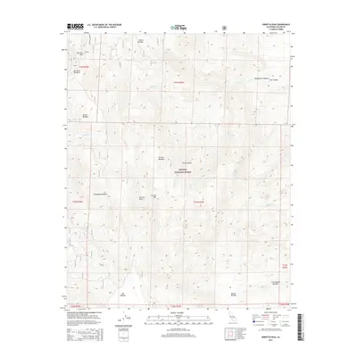
2015 Map of Sirretta Peak
USGS Topo · Published 2015About this map
Sirretta Peak rises as the central landmark within this high-altitude portion of the Sequoia National Forest. The landscape is characterized by a series of high mountain meadows that served as critical points of orientation and resource for early forest users, including Big Meadow, Manter Meadow, and the clustered Durrwood Meadows near Sherman Pass. These open spaces are connected by a network of Forest Service routes, such as Forest Rte 22S05A and 23s07, which navigate the complex drainage systems of Trout Cr and Little Trout Cr. The distribution of these named meadows, from Boone Meadow in the north to Little Manter Meadow in the south, indicates a historic pattern of seasonal land use and grazing common to the southern Sierra Nevada. The map preserves the specific locations of geographic crossings like Sirretta Pass and the distinctive topography of Dark Canyon.
Find a feature on this map
54 named features on this map. Tap any name to fly to it.
Don’t see what you’re looking for? This feature index may not catch every label — zoom into the map to look around manually.
Map Details
Editions of this 2015 Sirretta Peak Map
This is the sole edition of this map. No revisions or reprints were ever made.
Other maps of this area

1905 · Olancha
USGS Topo · 1:125,000

1905 · Fairview
USGS Topo · 1:24,000

1906 · Kernville
USGS Topo · 1:125,000

1907 · Olancha
USGS Topo · 1:125,000

1908 · Kernville
USGS Topo · 1:125,000

1918 · Fairview
USGS Topo · 1:31,680

1948 · Bakersfield
USGS Topo · 1:250,000

1948 · Fresno
USGS Topo · 1:250,000

1955 · Bakersfield
USGS Topo · 1:250,000

1955 · Fresno
USGS Topo · 1:250,000