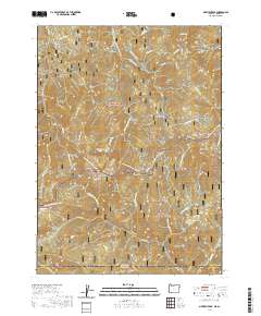
2020 Map of Siskiyou Peak
USGS Topo · Published 2020About this map
Siskiyou Peak and the high ridgelines of the Siskiyou Divide define this borderland where Oregon meets California. The landscape is a complex of high summits including Wagner Butte and McDonald Peak, separated by significant passes like Cinnabar Gap and Siskiyou Gap. Water management and natural drainage are central to the terrain, marked by the long reach of the McDonald Ditch and the headwaters of the Little Applegate River. Much of the territory falls within the Rogue River National Forest and Klamath National Forest, highlighting a region primarily dedicated to timber and recreation. Human passage through these heights is dominated by the Pacific Crest National Scenic Trail, which winds across the divide near Big Red Mtn and Jack Flat. The map also captures several distinct glades and gulches, such as Wymer Glade and Bear Gulch, which provide specific points of reference in an otherwise dense mountain wilderness.
Find a feature on this map
61 named features on this map. Tap any name to fly to it.
Don’t see what you’re looking for? This feature index may not catch every label — zoom into the map to look around manually.
Map Details
Editions of this 2020 Siskiyou Peak Map
This is the sole edition of this map. No revisions or reprints were ever made.
Other maps of this area

1886 · Shasta
USGS Topo · 1:250,000

1891 · Ashland
USGS Topo · 1:250,000

1893 · Ashland
USGS Topo · 1:250,000

1894 · Shasta
USGS Topo · 1:250,000

1897 · Ashland
USGS Topo · 1:250,000

1932 · Yreka
USGS Topo · 1:96,000

1938 · Medford
USGS Topo · 1:125,000

1939 · Yreka
USGS Topo · 1:125,000

1948 · Weed
USGS Topo · 1:250,000

1950 · Weed
USGS Topo · 1:250,000