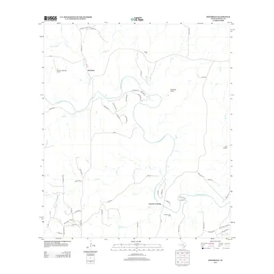
2013 Map of Sisterdale
USGS Topo · Published 2013About this map
Sisterdale serves as a central point of this Hill Country landscape, situated where W Sister Cr and E Sister Cr converge. The topography is defined by the winding course of the Guadalupe River, which carves through the terrain near Spicewood Canyon and creates natural crossing points like Ammans Crossing. This 2013 survey illustrates the modern rural character of Kendall County, showing a network of ranch roads and residential developments that follow the river's path, such as River Bluff Dr and Canyon Ridge Dr. Local heritage is preserved at the Werner Cem and the Guadalupe River Ranch, while the B. J. Mc Combs Sisterdale Airport indicates contemporary aviation use in this pastoral setting. Further south, Camp Alzafar and drainage features like Sabinas Cr and Wasp Cr highlight the region's recreational and hydrological importance.
Find a feature on this map
66 named features on this map. Tap any name to fly to it.
Don’t see what you’re looking for? This feature index may not catch every label — zoom into the map to look around manually.
Map Details
Editions of this 2013 Sisterdale Map
This is the sole edition of this map. No revisions or reprints were ever made.
Other maps of this area

1894 · Fredericksburg
USGS Topo · 1:125,000

1954 · Llano
USGS Topo · 1:250,000

1954 · San Antonio
USGS Topo · 1:250,000

1955 · Llano
USGS Topo · 1:250,000

1956 · Comfort
USGS Topo · 1:62,500

1956 · Llano
USGS Topo · 1:250,000

1957 · Boerne
USGS Topo · 1:62,500

1957 · San Antonio
USGS Topo · 1:250,000
1963 · Crabapple Creek
USGS Topo · 1:24,000

1963 · Whitworth Ranch
USGS Topo · 1:24,000