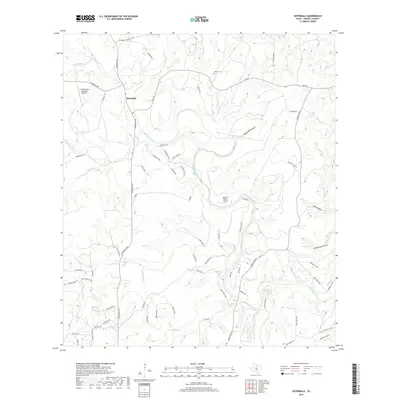
2019 Map of Sisterdale
USGS Topo · Published 2019About this map
Sisterdale serves as the focal point of this Central Texas landscape, situated at the confluence of W Sister Cr and E Sister Cr. The terrain is defined by the deep winding path of the Guadalupe River, which carves through the limestone country and is joined by numerous tributaries including Wasp Cr and Sabinas Cr. Local history is anchored by sites such as the Werner Cem and the distinctive Cave Without A Name in the southeast corner.
Find a feature on this map
72 named features on this map. Tap any name to fly to it.
Don’t see what you’re looking for? This feature index may not catch every label — zoom into the map to look around manually.
Map Details
Editions of this 2019 Sisterdale Map
This is the sole edition of this map. No revisions or reprints were ever made.
Other maps of this area

1894 · Fredericksburg
USGS Topo · 1:125,000

1954 · Llano
USGS Topo · 1:250,000

1954 · San Antonio
USGS Topo · 1:250,000

1955 · Llano
USGS Topo · 1:250,000

1956 · Comfort
USGS Topo · 1:62,500

1956 · Llano
USGS Topo · 1:250,000

1957 · Boerne
USGS Topo · 1:62,500

1957 · San Antonio
USGS Topo · 1:250,000
1963 · Crabapple Creek
USGS Topo · 1:24,000

1963 · Whitworth Ranch
USGS Topo · 1:24,000