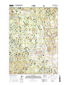
2017 Map of Sisters
USGS Topo · Published 2017About this map
Sisters serves as the central hub of this high-desert landscape, where the foothills of the Cascade Range meet the sprawling timberlands of the Deschutes National Forest. The map documents a complex interface of recreational development and historical transit routes, evidenced by the established community at Black Butte Ranch and Glaze Meadow to the northwest. Water management is a defining feature of the area's development, with Whychus Creek and Indian Ford Creek flowing through the territory, supported by infrastructure like the Smith Ditch and Red Ditch.
Find a feature on this map
72 named features on this map. Tap any name to fly to it.
Don’t see what you’re looking for? This feature index may not catch every label — zoom into the map to look around manually.
Map Details
Editions of this 2017 Sisters Map
This is the sole edition of this map. No revisions or reprints were ever made.
Other maps of this area

1926 · Bend
USGS Topo · 1:125,000

1929 · Bend
USGS Topo · 1:125,000

1929 · Three Sisters
USGS Topo · 1:125,000

1932 · Three Sisters
USGS Topo · 1:125,000

1955 · Bend
USGS Topo · 1:250,000

1957 · Bend
USGS Topo · 1:250,000

1958 · Bend
USGS Topo · 1:250,000

1959 · Broken Top
USGS Topo · 1:62,500

1959 · Sisters
USGS Topo · 1:62,500
1962 · Squaw Back Ridge
USGS Topo · 1:24,000