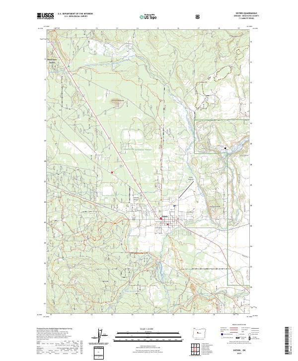
2023 Map of Sisters
USGS Topo · Published 2023About this map
Sisters serves as the focal point of this Central Oregon landscape, where the high desert meets the eastern slopes of the Cascade Range. The town's layout is defined by its proximity to Whychus Creek and the surrounding timberlands of the Deschutes National Forest. To the northwest, the residential and resort enclave of Black Butte Ranch sits near the foot of Black Butte, while the Sisters Eagle Air field and Sisters Cem mark the community's eastern edges.
Find a feature on this map
50 named features on this map. Tap any name to fly to it.
Don’t see what you’re looking for? This feature index may not catch every label — zoom into the map to look around manually.
Map Details
Editions of this 2023 Sisters Map
This is the sole edition of this map. No revisions or reprints were ever made.
Other maps of this area

1926 · Bend
USGS Topo · 1:125,000

1929 · Bend
USGS Topo · 1:125,000

1929 · Three Sisters
USGS Topo · 1:125,000

1932 · Three Sisters
USGS Topo · 1:125,000

1955 · Bend
USGS Topo · 1:250,000

1957 · Bend
USGS Topo · 1:250,000

1958 · Bend
USGS Topo · 1:250,000

1959 · Broken Top
USGS Topo · 1:62,500

1959 · Sisters
USGS Topo · 1:62,500
1962 · Squaw Back Ridge
USGS Topo · 1:24,000