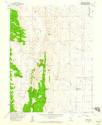
1958 Map of Sites
USGS Topo · Published 1960About this map
Antelope Valley and the surrounding foothills of western Colusa County are captured here during a period of established ranching and agricultural development. The small settlement of Sites serves as a central point, surrounded by family-named landmarks and infrastructure such as Huffmaster Road and Peterson Road. The landscape is defined by the sharp transition from the flat valley floor to the prominent Logan Ridge, with water sources like Funks Creek and Stone Corral Creek providing essential drainage for the region's cattle and grain operations.
Find a feature on this map
31 named features on this map. Tap any name to fly to it.
Don’t see what you’re looking for? This feature index may not catch every label — zoom into the map to look around manually.
Map Details
Editions of this 1958 Sites Map
3 editions found
Other maps of this area

1904 · Logan Creek
USGS Topo · 1:24,000

1904 · Sites
USGS Topo · 1:24,000

1905 · Fairview
USGS Topo · 1:24,000

1906 · Maxwell
USGS Topo · 1:62,500

1907 · Colusa
USGS Topo · 1:62,500

1917 · Logandale
USGS Topo · 1:31,680

1917 · Sites
USGS Topo · 1:31,680

1917 · Delevan
USGS Topo · 1:31,680

1918 · Williams
USGS Topo · 1:31,680

1918 · Logan Creek
USGS Topo · 1:31,680