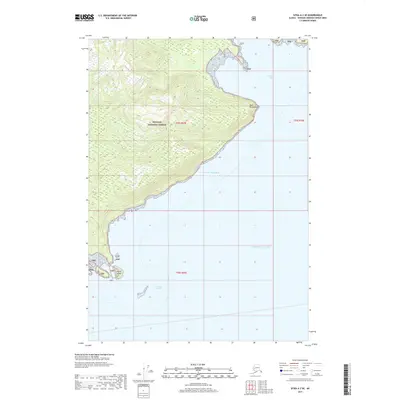
2017 Map of Sitka A-2 SE
USGS Topo · Published 2017About this map
Tongass National Forest dominates this coastal landscape, showing a dense network of contours rising sharply from the Pacific waters. The topography is defined by the steep elevation changes typical of the Alaskan coastline, with prominent landmarks such as Point Brightman marking the transition into the Gulf of Alaska. Near the northeastern edge of the sheet, Herring Bay provides a sheltered inlet against the more exposed maritime environment of Frederick Sound to the south. Small outcroppings like Carroll Island dot the nearshore waters, illustrating the fragmented nature of the archipelago. This 2017 survey reflects the enduring wilderness of the region, where the lack of roads or established settlements emphasizes the natural boundary between the temperate rainforest and the sea.
Find a feature on this map
11 named features on this map. Tap any name to fly to it.
Don’t see what you’re looking for? This feature index may not catch every label — zoom into the map to look around manually.
Map Details
Editions of this 2017 Sitka A-2 SE Map
This is the sole edition of this map. No revisions or reprints were ever made.
Other maps of this area

1948 · Sitka A-2
USGS Topo · 1:63,360

1948 · Port Alexander D-1
USGS Topo · 1:63,360

1948 · Sitka A-1
USGS Topo · 1:63,360

1951 · Sitka
USGS Topo · 1:250,000

1951 · Port Alexander
USGS Topo · 1:250,000

1951 · Port Alexander D-2
USGS Topo · 1:63,360

1951 · Sitka A-2
USGS Topo · 1:63,360

1952 · Port Alexander
USGS Topo · 1:250,000

1952 · Sitka
USGS Topo · 1:250,000

1964 · Sitka
USGS Topo · 1:250,000