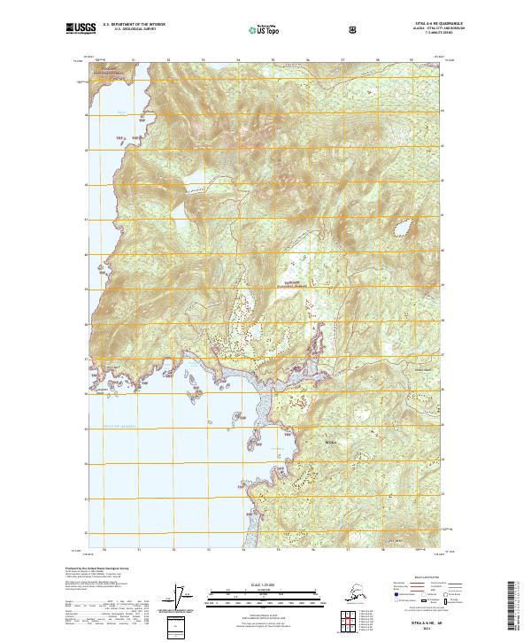
2021 Map of Sitka A-6 NE
USGS Topo · Published 2021About this map
Kruzof Island and the sprawling expanse of the Tongass National Forest dominate this coastal survey. The map details a complex maritime landscape where the Gulf of Alaska meets the shoreline at Shelikof Bay and Port Mary. An intricate network of trails and spurs, such as the Iris Meadows Road Trl and 7590 West Road Trl, suggests a region managed for timber and recreation, cutting through the dense forest towards landmarks like Shell Mtn and The Cone. The coastline is highly articulated, featuring sheltered waters like Cuvacan Cove and Goleta Cove, protected by landforms including Point Mary and Slaughter Island. This cartographic record provides a precise view of the geographic intersections between the North Pacific and the protected forest interior.
Find a feature on this map
40 named features on this map. Tap any name to fly to it.
Don’t see what you’re looking for? This feature index may not catch every label — zoom into the map to look around manually.
Map Details
Editions of this 2021 Sitka A-6 NE Map
This is the sole edition of this map. No revisions or reprints were ever made.
Other maps of this area

1948 · Sitka A-5
USGS Topo · 1:63,360

1948 · Sitka B-5
USGS Topo · 1:63,360

1951 · Sitka A-6
USGS Topo · 1:63,360

1951 · Sitka B-6
USGS Topo · 1:63,360

1951 · Sitka B-5
USGS Topo · 1:63,360

1951 · Sitka
USGS Topo · 1:250,000

1951 · Sitka A-5
USGS Topo · 1:63,360

1952 · Sitka
USGS Topo · 1:250,000

1964 · Sitka
USGS Topo · 1:250,000
1996 · Sitka A-5
USGS Topo · 1:63,360