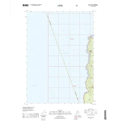
2017 Map of Sitka A-6 SW
USGS Topo · Published 2017About this map
Kruzof Island dominates the eastern portion of this coastal survey, where the dense woodlands of the Tongass National Forest meet the open waters of the Pacific Ocean. This maritime landscape is defined by its indented shoreline, stretching from the northern prominence of Beaver Point down toward the southern tip at Cape Edgecumbe. Between these points, the coastline is punctuated by features such as Engano Point and the sheltered waters of Neva Bay. The map highlights the intersection of land and sea at the edge of the Gulf of Alaska, showing a region where the vast forest remains largely untouched by development, preserved within the national forest system as it transitions into the expansive marine environment.
Find a feature on this map
12 named features on this map. Tap any name to fly to it.
Don’t see what you’re looking for? This feature index may not catch every label — zoom into the map to look around manually.
Map Details
Editions of this 2017 Sitka A-6 SW Map
This is the sole edition of this map. No revisions or reprints were ever made.
Other maps of this area

1951 · Sitka A-6
USGS Topo · 1:63,360

1951 · Sitka
USGS Topo · 1:250,000

1951 · Port Alexander
USGS Topo · 1:250,000

1952 · Port Alexander
USGS Topo · 1:250,000

1952 · Sitka
USGS Topo · 1:250,000

1964 · Sitka
USGS Topo · 1:250,000

1964 · Port Alexander
USGS Topo · 1:250,000
2017 · Sitka A-6 OE S NW
USGS Topo · 1:25,000
2017 · Sitka A-6 OE S NE
USGS Topo · 1:25,000
2017 · Sitka A-6 NE
USGS Topo · 1:25,000