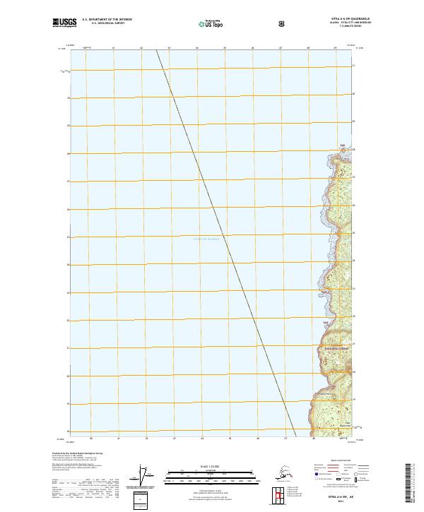
2021 Map of Sitka A-6 SW
USGS Topo · Published 2021About this map
Gulf of Alaska waters dominate this coastal survey, where the maritime boundary of the Tongass National Forest meets the open sea. The map documents a rugged section of shoreline defined by prominent navigational landmarks, including the northern Beaver Point and the southward projection of Engano Point. The terrain is characterized by the dense coastal forest of the Tnf designation, which reaches to the very edge of the Pacific. At the southern terminus, the landmass narrows toward the significant geographical marker of Cape Edgecumbe. This 2021 edition provides precise topographical data for this wilderness area, illustrating the intersection of federal forest lands and the exposed Alaskan coastline without the presence of established roads or settlements.
Find a feature on this map
8 named features on this map. Tap any name to fly to it.
Don’t see what you’re looking for? This feature index may not catch every label — zoom into the map to look around manually.
Map Details
Editions of this 2021 Sitka A-6 SW Map
This is the sole edition of this map. No revisions or reprints were ever made.
Other maps of this area

1951 · Sitka A-6
USGS Topo · 1:63,360

1951 · Sitka
USGS Topo · 1:250,000

1951 · Port Alexander
USGS Topo · 1:250,000

1952 · Port Alexander
USGS Topo · 1:250,000

1952 · Sitka
USGS Topo · 1:250,000

1964 · Sitka
USGS Topo · 1:250,000

1964 · Port Alexander
USGS Topo · 1:250,000
2017 · Sitka A-6 OE S NW
USGS Topo · 1:25,000
2017 · Sitka A-6 OE S NE
USGS Topo · 1:25,000
2017 · Sitka A-6 NE
USGS Topo · 1:25,000