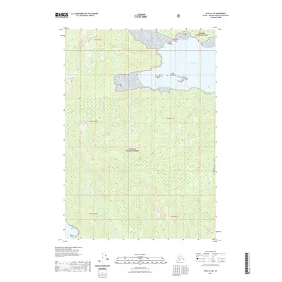
2021 Map of Sitka B-1 NE
USGS Topo · Published 2021About this map
Gambier Bay defines the northeastern coastline of this maritime landscape, where the sea meets the dense wilderness of the Tongass National Forest. The terrain is characterized by steep elevation changes and intricate waterways typical of Southeast Alaska's Alexander Archipelago. While primarily an uninhabited forest reserve, the map details the complex shoreline of the bay, including several small islands and inlets. These natural features are situated within several townships, including t50s r71e and t51s r71e, reflecting the formal land division of the region under the Public Land Survey System. The absence of roads or permanent settlements underscores the isolation of this coastal forest environment in the early twenty-first century.
Find a feature on this map
9 named features on this map. Tap any name to fly to it.
Don’t see what you’re looking for? This feature index may not catch every label — zoom into the map to look around manually.
Map Details
Editions of this 2021 Sitka B-1 NE Map
This is the sole edition of this map. No revisions or reprints were ever made.
Other maps of this area

1948 · Sitka B-1
USGS Topo · 1:63,360

1948 · Sitka C-1
USGS Topo · 1:63,360

1948 · Sumdum B-6
USGS Topo · 1:63,360

1948 · Sumdum C-6
USGS Topo · 1:63,360

1951 · Sitka
USGS Topo · 1:250,000

1951 · Sitka C-1
USGS Topo · 1:63,360

1951 · Sitka B-1
USGS Topo · 1:63,360

1951 · Sumdum C-6
USGS Topo · 1:63,360

1952 · Sumdum
USGS Topo · 1:250,000

1952 · Sitka
USGS Topo · 1:250,000