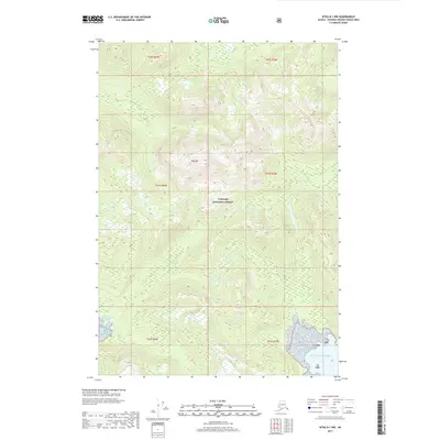
2017 Map of Sitka B-1 NW
USGS Topo · Published 2017About this map
Tongass National Forest dominates this coastal landscape in the Alexander Archipelago, showing the wild geography of Admiralty Island. The terrain is defined by steep ridges rising toward Mid Mtn, with a dense network of drainages feeding into local catchments like Pubus Lake. To the southwest, the shoreline is carved by the North Arm Hood Bay, while the southeastern corner of the map opens onto the expansive Gulf of Alaska. This 2017 survey by the U.S. Geological Survey documents the land as part of the Hoonah-Angoon Census Area, illustrating the complex topographical contouring of the region before any significant road development or modern settlement reached these specific interior slopes.
Find a feature on this map
12 named features on this map. Tap any name to fly to it.
Don’t see what you’re looking for? This feature index may not catch every label — zoom into the map to look around manually.
Map Details
Editions of this 2017 Sitka B-1 NW Map
This is the sole edition of this map. No revisions or reprints were ever made.
Other maps of this area

1948 · Sitka B-1
USGS Topo · 1:63,360

1948 · Sitka C-2
USGS Topo · 1:63,360

1948 · Sitka C-1
USGS Topo · 1:63,360

1948 · Sitka B-2
USGS Topo · 1:63,360

1951 · Sitka
USGS Topo · 1:250,000

1951 · Sitka C-1
USGS Topo · 1:63,360

1951 · Sitka B-2
USGS Topo · 1:63,360

1951 · Sitka B-1
USGS Topo · 1:63,360

1951 · Sitka C-2
USGS Topo · 1:63,360

1952 · Sitka
USGS Topo · 1:250,000