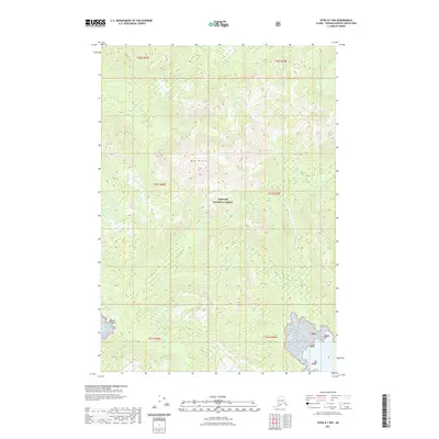
2021 Map of Sitka B-1 NW
USGS Topo · Published 2021About this map
Tongass National Forest dominates this topographic survey of the Alaskan wilderness within the Unorganized Borough. The landscape is defined by the significant elevation of Mid Mtn, which rises above a series of drainages and glaciated valleys. The presence of Pybus Lake in the eastern portion of the quadrangle provides a key freshwater reference point amidst the densely forested and high-relief terrain typical of the Alexander Archipelago. The map serves as a contemporary record of this remote area, documenting the natural hydrography and elevation contours as they existed in the early twenty-first century, with few signs of human infrastructure beyond the established boundaries of the national forest.
Find a feature on this map
10 named features on this map. Tap any name to fly to it.
Don’t see what you’re looking for? This feature index may not catch every label — zoom into the map to look around manually.
Map Details
Editions of this 2021 Sitka B-1 NW Map
This is the sole edition of this map. No revisions or reprints were ever made.
Other maps of this area

1948 · Sitka B-1
USGS Topo · 1:63,360

1948 · Sitka C-2
USGS Topo · 1:63,360

1948 · Sitka C-1
USGS Topo · 1:63,360

1948 · Sitka B-2
USGS Topo · 1:63,360

1951 · Sitka
USGS Topo · 1:250,000

1951 · Sitka C-1
USGS Topo · 1:63,360

1951 · Sitka B-2
USGS Topo · 1:63,360

1951 · Sitka B-1
USGS Topo · 1:63,360

1951 · Sitka C-2
USGS Topo · 1:63,360

1952 · Sitka
USGS Topo · 1:250,000