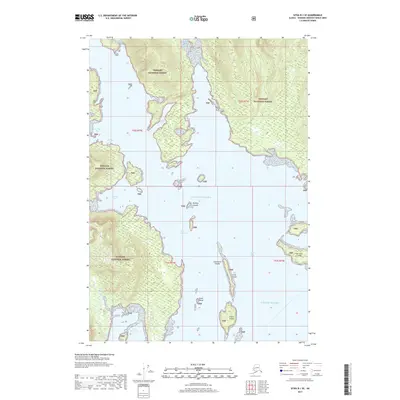
2017 Map of Sitka B-1 SE
USGS Topo · Published 2017About this map
Pybus Bay and the surrounding coastline of the Tongass National Forest dominate this maritime survey of the Hoonah-Angoon region. The intricate shoreline of Admiralty Island is punctuated by protected anchorages like Cannery Cove and Donkey Bay, which serve as vital points of interest for historical coastal navigation. The waterway divides into the West Channel and opens toward the Gulf of Alaska, framing a series of scattered landforms including Long Island and the San Juan Islands.
Find a feature on this map
21 named features on this map. Tap any name to fly to it.
Don’t see what you’re looking for? This feature index may not catch every label — zoom into the map to look around manually.
Map Details
Editions of this 2017 Sitka B-1 SE Map
This is the sole edition of this map. No revisions or reprints were ever made.
Other maps of this area

1948 · Sitka B-1
USGS Topo · 1:63,360

1948 · Sumdum A-6
USGS Topo · 1:63,360

1948 · Sumdum B-6
USGS Topo · 1:63,360

1948 · Sitka A-1
USGS Topo · 1:63,360

1951 · Sitka
USGS Topo · 1:250,000

1951 · Sitka B-1
USGS Topo · 1:63,360

1952 · Sumdum
USGS Topo · 1:250,000

1952 · Sitka
USGS Topo · 1:250,000

1961 · Sumdum
USGS Topo · 1:250,000

1964 · Sitka
USGS Topo · 1:250,000