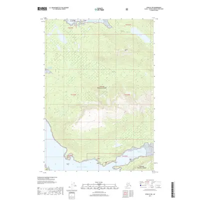
2017 Map of Sitka B-2 NE
USGS Topo · Published 2017About this map
Tongass National Forest dominates this coastal landscape on Admiralty Island, where the wilderness of the Gulf of Alaska meets the intricate waterways of the Alexander Archipelago. The terrain is defined by significant elevation changes, centered around the heights of Kanalku Mtn. In the northern portion of the map, Kanalku Lake feeds toward the coast, while the southern shoreline is carved by the deep inlet of North Arm Hood Bay. This 2017 survey illustrates the complex maritime geography of the region, from the exposed reaches near Cabin Point to the protected waters of Kanalku Bay, capturing a territory where the environment remains largely dictated by natural landforms and tidal reach rather than human infrastructure.
Find a feature on this map
13 named features on this map. Tap any name to fly to it.
Don’t see what you’re looking for? This feature index may not catch every label — zoom into the map to look around manually.
Map Details
Editions of this 2017 Sitka B-2 NE Map
This is the sole edition of this map. No revisions or reprints were ever made.
Other maps of this area

1948 · Sitka B-1
USGS Topo · 1:63,360

1948 · Sitka C-2
USGS Topo · 1:63,360

1948 · Sitka C-1
USGS Topo · 1:63,360

1948 · Sitka B-2
USGS Topo · 1:63,360

1951 · Sitka
USGS Topo · 1:250,000

1951 · Sitka C-1
USGS Topo · 1:63,360

1951 · Sitka B-2
USGS Topo · 1:63,360

1951 · Sitka B-1
USGS Topo · 1:63,360

1951 · Sitka C-2
USGS Topo · 1:63,360

1952 · Sitka
USGS Topo · 1:250,000