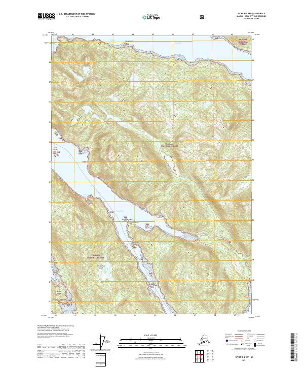
2021 Map of Sitka B-5 SW
USGS Topo · Published 2021About this map
Tongass National Forest dominates this coastal Alaska landscape, where the intricate shoreline of Partofshikof Island meets the waters of the Neva Strait. The topography is defined by the steep, timbered ridges of the Alexander Archipelago, dropping sharply into deep-water inlets like Saint John Baptist Bay and Fish Bay. These waterways served as critical maritime corridors long before the modern era, with landmarks such as Wyvill Reef and Columbine Rock marking the navigational hazards of the passage.
Find a feature on this map
28 named features on this map. Tap any name to fly to it.
Don’t see what you’re looking for? This feature index may not catch every label — zoom into the map to look around manually.
Map Details
Editions of this 2021 Sitka B-5 SW Map
This is the sole edition of this map. No revisions or reprints were ever made.
Other maps of this area

1948 · Sitka A-5
USGS Topo · 1:63,360

1948 · Sitka B-5
USGS Topo · 1:63,360

1951 · Sitka A-6
USGS Topo · 1:63,360

1951 · Sitka B-6
USGS Topo · 1:63,360

1951 · Sitka B-5
USGS Topo · 1:63,360

1951 · Sitka
USGS Topo · 1:250,000

1951 · Sitka A-5
USGS Topo · 1:63,360

1952 · Sitka
USGS Topo · 1:250,000

1964 · Sitka
USGS Topo · 1:250,000
1996 · Sitka A-5
USGS Topo · 1:63,360