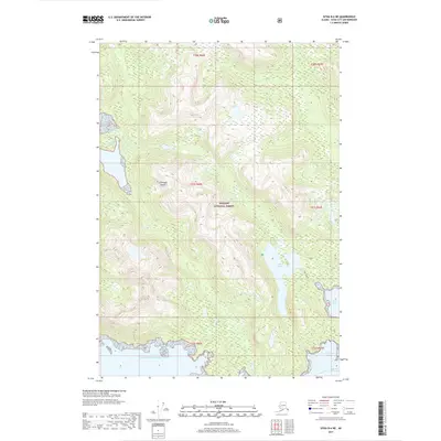
2017 Map of Sitka B-6 NE
USGS Topo · Published 2017About this map
Tongass National Forest dominates this coastal portion of Chichagof Island, where the terrain drops sharply toward the Gulf of Alaska. The landscape is defined by its complex shoreline and inland freshwater bodies, most notably the elongated Lake Suloia which sits just inland from the saltwater of Suloia Bay. These physical features dictate the natural corridors of the region, including the maritime passage of Kakul Narrows at the southern edge of the sheet.
Find a feature on this map
15 named features on this map. Tap any name to fly to it.
Don’t see what you’re looking for? This feature index may not catch every label — zoom into the map to look around manually.
Map Details
Editions of this 2017 Sitka B-6 NE Map
This is the sole edition of this map. No revisions or reprints were ever made.
Other maps of this area

1948 · Sitka C-6
USGS Topo · 1:63,360

1948 · Sitka B-5
USGS Topo · 1:63,360

1951 · Sitka C-5
USGS Topo · 1:63,360

1951 · Sitka B-6
USGS Topo · 1:63,360

1951 · Sitka B-5
USGS Topo · 1:63,360

1951 · Sitka
USGS Topo · 1:250,000

1951 · Sitka C-6
USGS Topo · 1:63,360

1952 · Sitka
USGS Topo · 1:250,000

1964 · Sitka
USGS Topo · 1:250,000
1996 · Sitka B-6
USGS Topo · 1:63,360