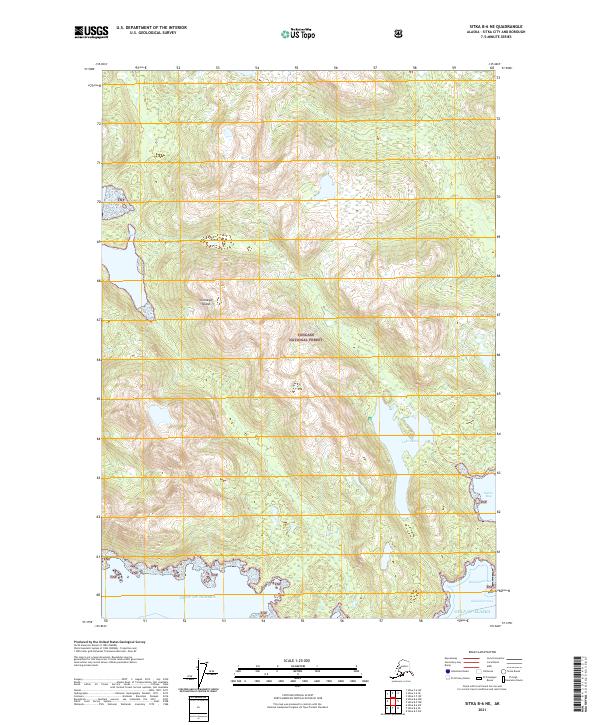
2021 Map of Sitka B-6 NE
USGS Topo · Published 2021About this map
Chichagof Island defines the dramatic maritime landscape shown in this contemporary topographical record, where the protected waters of Hidden Cove and Suloia Bay meet the open Gulf of Alaska. Managed within the Tongass National Forest, the region is characterized by steep coastal gradients rising directly from sea level to high ridges, punctuated by inland water bodies like Lake Suloia. Narrow passages such as Kakul Narrow and smaller inlets like Bradshaw Cove illustrate the complex shoreline of this archipelago. The drainage patterns of the island are exemplified by Leo Cr, which flows through the dense forest into the northwestern coast. This document provides a precise account of the natural topography and established forest boundaries in a region where human settlement is secondary to the coastal wilderness.
Find a feature on this map
16 named features on this map. Tap any name to fly to it.
Don’t see what you’re looking for? This feature index may not catch every label — zoom into the map to look around manually.
Map Details
Editions of this 2021 Sitka B-6 NE Map
This is the sole edition of this map. No revisions or reprints were ever made.
Other maps of this area

1948 · Sitka C-6
USGS Topo · 1:63,360

1948 · Sitka B-5
USGS Topo · 1:63,360

1951 · Sitka C-5
USGS Topo · 1:63,360

1951 · Sitka B-6
USGS Topo · 1:63,360

1951 · Sitka B-5
USGS Topo · 1:63,360

1951 · Sitka
USGS Topo · 1:250,000

1951 · Sitka C-6
USGS Topo · 1:63,360

1952 · Sitka
USGS Topo · 1:250,000

1964 · Sitka
USGS Topo · 1:250,000
1996 · Sitka B-6
USGS Topo · 1:63,360