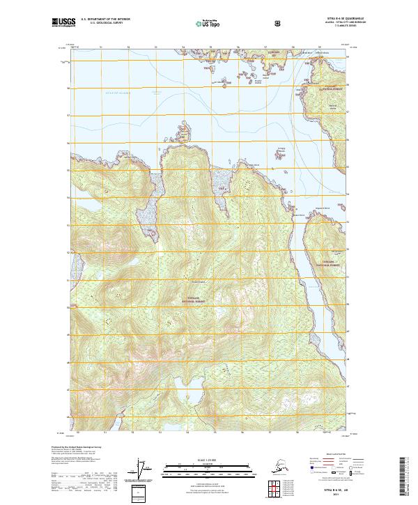
2021 Map of Sitka B-6 SE
USGS Topo · Published 2021About this map
Tongass National Forest dominates this coastal landscape, covering the sprawling terrain of Kruzof Island and the western reaches of Baranof Island. The map illustrates the complex waterway system of the Alexander Archipelago, where the Gulf of Alaska meets protected passages like Salisbury Sound and the narrow Neva Strait. Local history and land use are reflected in the access routes through the dense timber, including the Eagle River Trl, Gilmer Bay Spur, and Gilmer Spur 2. These paths provide a rare terrestrial connection to interior landmarks like Lake Surprise and the sheltered waters of Gilmer Bay. The coastal perimeter is dotted with hazards and navigational points such as Channel Rocks, Point Kakul, and Sukoi Point, marking the transition from open sea to the intricate inlets that define the Sitka region's maritime character.
Find a feature on this map
32 named features on this map. Tap any name to fly to it.
Don’t see what you’re looking for? This feature index may not catch every label — zoom into the map to look around manually.
Map Details
Editions of this 2021 Sitka B-6 SE Map
This is the sole edition of this map. No revisions or reprints were ever made.
Other maps of this area

1948 · Sitka A-5
USGS Topo · 1:63,360

1948 · Sitka B-5
USGS Topo · 1:63,360

1951 · Sitka A-6
USGS Topo · 1:63,360

1951 · Sitka B-6
USGS Topo · 1:63,360

1951 · Sitka B-5
USGS Topo · 1:63,360

1951 · Sitka
USGS Topo · 1:250,000

1951 · Sitka A-5
USGS Topo · 1:63,360

1952 · Sitka
USGS Topo · 1:250,000

1964 · Sitka
USGS Topo · 1:250,000
1996 · Sitka A-5
USGS Topo · 1:63,360