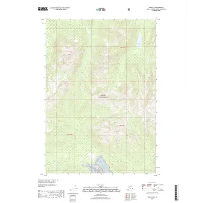
2017 Map of Sitka C-1 SE
USGS Topo · Published 2017About this map
Tongass National Forest dominates this Alaskan landscape, characterized by dramatic coastal elevations and complex hydrography. The terrain is anchored by the prominent peak of Mt Distik, which rises sharply within the northern townships. In the northeast, Pleasant Bay Lake provides a significant water feature amidst the dense forested interior, while the Mole River traces its path along the western edge. This 2017 survey by the U.S. Geological Survey reflects the enduring wilderness of the Hoonah-Angoon Census Area, where land use is defined by federal forest management rather than urban development. The mapping detail highlights the intricate drainage patterns and steep contour gradients typical of Southeast Alaska's island and coastal geography.
Find a feature on this map
8 named features on this map. Tap any name to fly to it.
Don’t see what you’re looking for? This feature index may not catch every label — zoom into the map to look around manually.
Map Details
Editions of this 2017 Sitka C-1 SE Map
This is the sole edition of this map. No revisions or reprints were ever made.
Other maps of this area

1948 · Sitka B-1
USGS Topo · 1:63,360

1948 · Sitka C-1
USGS Topo · 1:63,360

1948 · Sumdum B-6
USGS Topo · 1:63,360

1948 · Sumdum C-6
USGS Topo · 1:63,360

1951 · Sitka
USGS Topo · 1:250,000

1951 · Sitka C-1
USGS Topo · 1:63,360

1951 · Sitka B-1
USGS Topo · 1:63,360

1951 · Sumdum C-6
USGS Topo · 1:63,360

1952 · Sumdum
USGS Topo · 1:250,000

1952 · Sitka
USGS Topo · 1:250,000