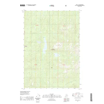
2021 Map of Sitka C-1 SW
USGS Topo · Published 2021About this map
Admiralty Island dominates this 2021 survey, where the interior wilderness is defined by the high peaks of Yellow Bear Mtn and Botany Peak. This landscape within the Tongass National Forest is characterized by a dense network of high-altitude drainages and marshy basins. The center of the quadrangle is marked by Jims Lake, which serves as a significant hydrological collector for Jims Creek and other unnamed tributaries flowing through the central valley. To the northeast, the Hasselborg Cr winds through the hills, while the eastern edge is defined by the steep descent toward the Mole River. The map provides a precise look at the township and range lines across this roadless terrain, showing the rugged topography that has historically isolated these interior sections of the island.
Find a feature on this map
13 named features on this map. Tap any name to fly to it.
Don’t see what you’re looking for? This feature index may not catch every label — zoom into the map to look around manually.
Map Details
Editions of this 2021 Sitka C-1 SW Map
This is the sole edition of this map. No revisions or reprints were ever made.
Other maps of this area

1948 · Sitka B-1
USGS Topo · 1:63,360

1948 · Sitka C-2
USGS Topo · 1:63,360

1948 · Sitka C-1
USGS Topo · 1:63,360

1948 · Sitka B-2
USGS Topo · 1:63,360

1951 · Sitka
USGS Topo · 1:250,000

1951 · Sitka C-1
USGS Topo · 1:63,360

1951 · Sitka B-2
USGS Topo · 1:63,360

1951 · Sitka B-1
USGS Topo · 1:63,360

1951 · Sitka C-2
USGS Topo · 1:63,360

1952 · Sitka
USGS Topo · 1:250,000