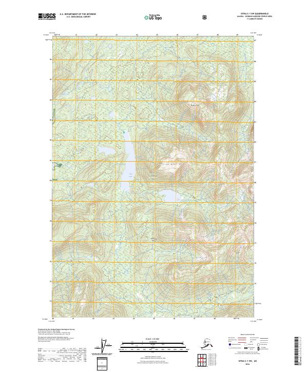
2024 Map of Sitka C-1 SW
USGS Topo · Published 2024About this map
Admiralty Island dominates this part of the Alexander Archipelago, where the interior landscape is defined by the protected reaches of the Kootznoowoo Wilderness and the Admiralty Island National Monument. This terrain is characterized by high ridges such as Yellow Bear Mtn and Botany Peak, which rise above a complex network of freshwater systems. The map details the drainage of Hasselborg Creek and the central waters of Jims Lake, which feeds into Jims Creek. In the northeast, the Mole River carves through the dense timber of the Tongass National Forest. The absence of developed roads or settlements highlights the wilderness character of the island, which remains a critical habitat for wildlife and a site of significance for the Tlingit people within their ancestral lands.
Find a feature on this map
14 named features on this map. Tap any name to fly to it.
Don’t see what you’re looking for? This feature index may not catch every label — zoom into the map to look around manually.
Map Details
Editions of this 2024 Sitka C-1 SW Map
This is the sole edition of this map. No revisions or reprints were ever made.
Other maps of this area

1948 · Sitka B-1
USGS Topo · 1:63,360

1948 · Sitka C-2
USGS Topo · 1:63,360

1948 · Sitka C-1
USGS Topo · 1:63,360

1948 · Sitka B-2
USGS Topo · 1:63,360

1951 · Sitka
USGS Topo · 1:250,000

1951 · Sitka C-1
USGS Topo · 1:63,360

1951 · Sitka B-2
USGS Topo · 1:63,360

1951 · Sitka B-1
USGS Topo · 1:63,360

1951 · Sitka C-2
USGS Topo · 1:63,360

1952 · Sitka
USGS Topo · 1:250,000