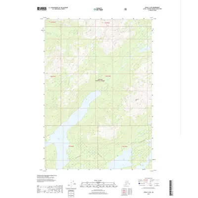
2017 Map of Sitka C-2 NE
USGS Topo · Published 2017About this map
Tongass National Forest dominates this Alaskan landscape, characterized by a complex network of freshwater bodies and elevation extremes. Large lakes such as Thayer Lake, Distin Lake, and Davidson Lake serve as primary geographical anchors in the southern portion of the quadrangle. The topography is defined by significant landmarks like Thayer Mtn, while water systems including Thayer Cr and Sikady Lake drain the northern reaches. Evidence of human passage through this wilderness is documented by designated routes such as Distin to Thayer and Guerin to Distin, which link the various lake basins. This map provides a detailed view of the natural hydrology and land divisions within the Unorganized Borough during the early twenty-first century, showing the exact placement of smaller features like McKinney Lake and Lake Guerin relative to the high peaks.
Find a feature on this map
17 named features on this map. Tap any name to fly to it.
Don’t see what you’re looking for? This feature index may not catch every label — zoom into the map to look around manually.
Map Details
Editions of this 2017 Sitka C-2 NE Map
This is the sole edition of this map. No revisions or reprints were ever made.
Other maps of this area

1948 · Sitka D-1
USGS Topo · 1:63,360

1948 · Sitka C-2
USGS Topo · 1:63,360

1948 · Sitka D-2
USGS Topo · 1:63,360

1948 · Sitka C-1
USGS Topo · 1:63,360

1951 · Sitka
USGS Topo · 1:250,000

1951 · Sitka D-1
USGS Topo · 1:63,360

1951 · Sitka C-1
USGS Topo · 1:63,360

1951 · Sitka D-2
USGS Topo · 1:63,360

1951 · Sitka C-2
USGS Topo · 1:63,360

1952 · Sitka
USGS Topo · 1:250,000