
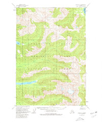
1951 Map of Sitka D-2
USGS Topo · Published 1974About this map
Admiralty Island dominates this mid-century topographical survey, showcasing a landscape defined by dramatic elevation and complex interior drainage. At the heart of this portion of the Tongass National Forest lie several significant freshwater bodies, including the elongated Lake Florence and the high-elevation Lake Kathleen. The map reveals a wild coastal environment where the rugged interior is carved by numerous watercourses such as Wheeler Creek and Pack Creek, which flow toward the salt water of Swan Cove. While largely devoid of permanent settlements, a solitary Cabin situated near the north shore of Lake Florence suggests the presence of seasonal resource use or early wilderness management. The drainage patterns of Fishery Cr and Ward Creek further illustrate the watershed's importance to the regional ecosystem during this 1951 field study, providing a baseline of the island's geography before later decades of development.
Find a feature on this map
10 named features on this map. Tap any name to fly to it.
Don’t see what you’re looking for? This feature index may not catch every label — zoom into the map to look around manually.
Map Details
Editions of this 1951 Sitka D-2 Map
2 editions found
Other maps of this area

1948 · Juneau A-3
USGS Topo · 1:63,360

1948 · Sitka D-1
USGS Topo · 1:63,360

1948 · Sitka C-2
USGS Topo · 1:63,360

1948 · Sitka C-3
USGS Topo · 1:63,360

1948 · Sitka D-3
USGS Topo · 1:63,360

1948 · Sitka D-2
USGS Topo · 1:63,360

1948 · Sitka C-1
USGS Topo · 1:63,360

1950 · Juneau A-3
USGS Topo · 1:63,360

1951 · Juneau
USGS Topo · 1:250,000

1951 · Juneau A-2
USGS Topo · 1:63,360