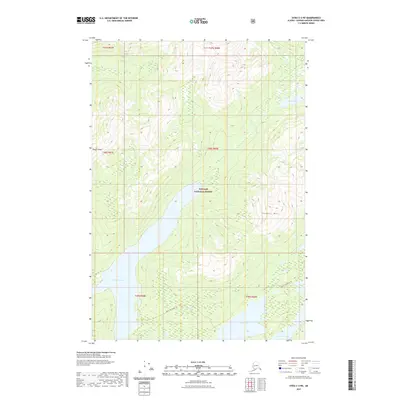
2021 Map of Sitka C-2 NE
USGS Topo · Published 2021About this map
Tongass National Forest encompasses the entirety of this coastal landscape, defined by a complex network of glacial lakes and mountainous terrain. The map highlights a series of significant inland waters, most notably the long stretch of Thayer Lake and the smaller Distin Lake and Davidson Lake situated to the southeast. These water bodies are connected by a primitive transportation network consisting of the Distin To Thayer Trl and the Guerin To Distin Trl, suggesting a landscape utilized primarily for forestry management and backcountry access. Elevations rise sharply from the lakeshores toward prominent landmarks such as Thayer Peak in the northwest and Thayer Mtn in the east, while Thayer Cr and its tributaries drain the surrounding high country.
Find a feature on this map
16 named features on this map. Tap any name to fly to it.
Don’t see what you’re looking for? This feature index may not catch every label — zoom into the map to look around manually.
Map Details
Editions of this 2021 Sitka C-2 NE Map
This is the sole edition of this map. No revisions or reprints were ever made.
Other maps of this area

1948 · Sitka D-1
USGS Topo · 1:63,360

1948 · Sitka C-2
USGS Topo · 1:63,360

1948 · Sitka D-2
USGS Topo · 1:63,360

1948 · Sitka C-1
USGS Topo · 1:63,360

1951 · Sitka
USGS Topo · 1:250,000

1951 · Sitka D-1
USGS Topo · 1:63,360

1951 · Sitka C-1
USGS Topo · 1:63,360

1951 · Sitka D-2
USGS Topo · 1:63,360

1951 · Sitka C-2
USGS Topo · 1:63,360

1952 · Sitka
USGS Topo · 1:250,000