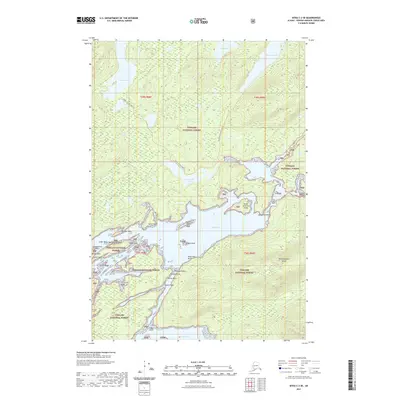
2021 Map of Sitka C-2 SE
USGS Topo · Published 2021About this map
Tongass National Forest dominates this coastal Alaskan landscape, where the intricate shoreline of Mitchell Bay meets a network of freshwater bodies. The map reveals a transition from tidal waters to interior lakes, notably Thayer Lake and Davidson Lake, which are connected to the saltwater through designated routes like the Thayer To Salt Lake Trl and Davidson To Salt Lake Trl. This area of the Hoonah-Angoon Census Area is characterized by numerous islands and named points, including Woodchoppers Island and Deception Island. The presence of landmarks such as Dead Tree Bluff and Kluchman Rock suggests a maritime environment where coastal navigation and interior portage were essential. The map serves as a detailed record of this unorganized borough's geography, from the depths of Kanalku Bay to the high ridges of the surrounding forest.
Find a feature on this map
33 named features on this map. Tap any name to fly to it.
Don’t see what you’re looking for? This feature index may not catch every label — zoom into the map to look around manually.
Map Details
Editions of this 2021 Sitka C-2 SE Map
This is the sole edition of this map. No revisions or reprints were ever made.
Other maps of this area

1948 · Sitka B-1
USGS Topo · 1:63,360

1948 · Sitka C-2
USGS Topo · 1:63,360

1948 · Sitka C-1
USGS Topo · 1:63,360

1948 · Sitka B-2
USGS Topo · 1:63,360

1951 · Sitka
USGS Topo · 1:250,000

1951 · Sitka C-1
USGS Topo · 1:63,360

1951 · Sitka B-2
USGS Topo · 1:63,360

1951 · Sitka B-1
USGS Topo · 1:63,360

1951 · Sitka C-2
USGS Topo · 1:63,360

1952 · Sitka
USGS Topo · 1:250,000