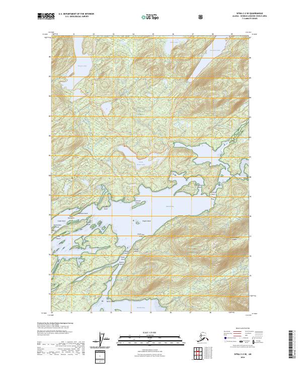
2024 Map of Sitka C-2 SE
USGS Topo · Published 2024About this map
Kootznoowoo Wilderness defines the dense topography of Admiralty Island, where saltwater channels and freshwater lakes meet within the Tongass National Forest. This modern survey illustrates the complex coastline of Mitchell Bay, a labyrinth of inlets and points including North Point and Hemlock Point. The landscape is tied together by a network of terrestrial paths such as the Thayer To Salt Lake Trl and the Davidson To Salt Lake Trl, which connect the interior Thayer Lake and Davidson Lake to the tidal waters. Coastal features like Dead Tree Bluff and Termination Point serve as critical landmarks for navigating the intricate waterways between Admiralty Island National Monument and the various named islands, including Diamond Island and Woodchoppers Island.
Find a feature on this map
34 named features on this map. Tap any name to fly to it.
Don’t see what you’re looking for? This feature index may not catch every label — zoom into the map to look around manually.
Map Details
Editions of this 2024 Sitka C-2 SE Map
This is the sole edition of this map. No revisions or reprints were ever made.
Other maps of this area

1948 · Sitka B-1
USGS Topo · 1:63,360

1948 · Sitka C-2
USGS Topo · 1:63,360

1948 · Sitka C-1
USGS Topo · 1:63,360

1948 · Sitka B-2
USGS Topo · 1:63,360

1951 · Sitka
USGS Topo · 1:250,000

1951 · Sitka C-1
USGS Topo · 1:63,360

1951 · Sitka B-2
USGS Topo · 1:63,360

1951 · Sitka B-1
USGS Topo · 1:63,360

1951 · Sitka C-2
USGS Topo · 1:63,360

1952 · Sitka
USGS Topo · 1:250,000