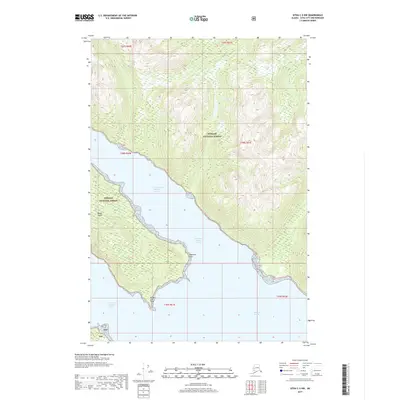
2017 Map of Sitka C-5 NW
USGS Topo · Published 2017About this map
Tongass National Forest dominates the coastal wilderness shown in this 2017 survey, where the intricate maritime landscape of Southeast Alaska is defined by steep, timbered ridges and deep glacial waters. The chart centers on the confluence of the North Arm Hoonah Sound and the main body of Hoonah Sound, capturing the remote shoreline at a moment of modern topographic precision. Significant navigational landmarks include the prominent Pedersen Point and the southern reach of Moser Island. To the south, the map extends toward White Cliff Point and the entrance of the South Arm Hoonah Sound. This data provides a detailed look at the island-and-inlet geography, tracing the Public Land Survey System grids across mountainous terrain where few human structures exist, emphasizing the preserved character of the Alaskan panhandle.
Find a feature on this map
13 named features on this map. Tap any name to fly to it.
Don’t see what you’re looking for? This feature index may not catch every label — zoom into the map to look around manually.
Map Details
Editions of this 2017 Sitka C-5 NW Map
This is the sole edition of this map. No revisions or reprints were ever made.
Other maps of this area

1948 · Sitka D-5
USGS Topo · 1:63,360

1948 · Sitka C-6
USGS Topo · 1:63,360

1948 · Sitka D-6
USGS Topo · 1:63,360

1951 · Sitka C-5
USGS Topo · 1:63,360

1951 · Sitka
USGS Topo · 1:250,000

1951 · Sitka C-6
USGS Topo · 1:63,360

1951 · Sitka D-6
USGS Topo · 1:63,360

1951 · Sitka D-5
USGS Topo · 1:63,360

1952 · Sitka
USGS Topo · 1:250,000

1964 · Sitka
USGS Topo · 1:250,000