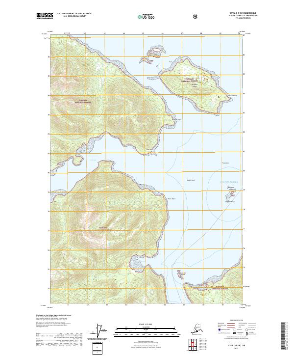
2021 Map of Sitka C-5 SW
USGS Topo · Published 2021About this map
Tongass National Forest dominates the coastal landscape of this 2021 survey, covering a complex network of islands and deep inlets along the Gulf of Alaska. The map centers on the dramatic relief surrounding Ushk Bay and the waterway of Poison Cove, where steep forested slopes drop directly into the Pacific waters. Navigational landmarks like Emmons Point and Rodgers Point define the coastline of larger landmasses like Emmons Island.
Find a feature on this map
21 named features on this map. Tap any name to fly to it.
Don’t see what you’re looking for? This feature index may not catch every label — zoom into the map to look around manually.
Map Details
Editions of this 2021 Sitka C-5 SW Map
This is the sole edition of this map. No revisions or reprints were ever made.
Other maps of this area

1948 · Sitka C-6
USGS Topo · 1:63,360

1948 · Sitka B-5
USGS Topo · 1:63,360

1951 · Sitka C-5
USGS Topo · 1:63,360

1951 · Sitka B-6
USGS Topo · 1:63,360

1951 · Sitka B-5
USGS Topo · 1:63,360

1951 · Sitka
USGS Topo · 1:250,000

1951 · Sitka C-6
USGS Topo · 1:63,360

1952 · Sitka
USGS Topo · 1:250,000

1964 · Sitka
USGS Topo · 1:250,000
1996 · Sitka B-6
USGS Topo · 1:63,360