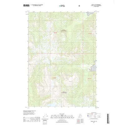
2017 Map of Sitka C-6 SE
USGS Topo · Published 2017About this map
Tongass National Forest dominates this topographic portrait, where the landscape is defined by its deep isolation and dramatic vertical relief. This 2017 survey details a remote interior portion of the Alexander Archipelago, where the Public Land Survey System grids, including T49s R60e and T50s R60e, meet the natural complexity of the Alaskan coastal range. The cartography focuses on the intricate drainage patterns and steep elevation changes that characterize this wilderness, revealing a landscape largely untouched by permanent settlements or commercial infrastructure. For researchers and land managers, the data from the National Hydrography Dataset and National Elevation Dataset provides a precise view of the terrain within the forest boundaries at a moment when digital mapping standards were becoming increasingly refined.
Find a feature on this map
5 named features on this map. Tap any name to fly to it.
Don’t see what you’re looking for? This feature index may not catch every label — zoom into the map to look around manually.
Map Details
Editions of this 2017 Sitka C-6 SE Map
This is the sole edition of this map. No revisions or reprints were ever made.
Other maps of this area

1948 · Sitka C-6
USGS Topo · 1:63,360

1948 · Sitka B-5
USGS Topo · 1:63,360

1951 · Sitka C-5
USGS Topo · 1:63,360

1951 · Sitka B-6
USGS Topo · 1:63,360

1951 · Sitka B-5
USGS Topo · 1:63,360

1951 · Sitka
USGS Topo · 1:250,000

1951 · Sitka C-6
USGS Topo · 1:63,360

1952 · Sitka
USGS Topo · 1:250,000

1964 · Sitka
USGS Topo · 1:250,000
1996 · Sitka B-6
USGS Topo · 1:63,360