
1951 Map of Sitka C-6
USGS Topo · Published 1963About this map
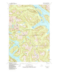
Chichagof Island is defined by an intricate network of fjords and sounds, as documented in this early 1950s survey of Southeast Alaska's Alexander Archipelago. The landscape is dominated by the deep incisions of North Arm Hoonah Sound and South Arm Hoonah Sound, which isolate peaks like Hirst Mtn and Rust Mtn from the coastline. Evidence of human presence is sparse, confined primarily to seasonal or resource-based Cabins tucked away in Fick Cove. The mapping reflects a maritime economy and environment where transportation relied entirely on the water, highlighting features like the Slocum Arm and Patterson Bay. Large Tidal Flats and inland water bodies such as Waterfall Lake and Sister Lake suggest a complex hydrologic system fed by the high peaks of the Khaz Peninsula.
Find a feature on this map
29 named features on this map. Tap any name to fly to it.
Don’t see what you’re looking for? This feature index may not catch every label — zoom into the map to look around manually.
Map Details
Editions of this 1951 Sitka C-6 Map
2 editions found
Other maps of this area

1948 · Sitka C-7
USGS Topo · 1:63,360

1948 · Sitka D-5
USGS Topo · 1:63,360

1948 · Sitka C-6
USGS Topo · 1:63,360

1948 · Sitka D-6
USGS Topo · 1:63,360

1948 · Sitka B-5
USGS Topo · 1:63,360

1951 · Sitka D-7
USGS Topo · 1:63,360

1951 · Sitka C-5
USGS Topo · 1:63,360

1951 · Sitka B-6
USGS Topo · 1:63,360

1951 · Sitka B-5
USGS Topo · 1:63,360

1951 · Sitka
USGS Topo · 1:250,000