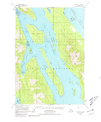
1951 Map of Sitka D-1
USGS Topo · Published 1980About this map
Admiralty Island National Monument dominates this mid-century coastal survey, illustrating the complex intersection of deep waterways and high mountain peaks. The map details the central reach of Seymour Canal, which splits the island's landscape between the peaks of Randolph Peak and Morse Peak to the east and the inland waters of Hasselborg Lake to the southwest. Significant for those tracking early conservation and research infrastructure, the map identifies a Bear Observatory along Pack Creek and various shelter cabins and cabins scattered along the rugged shoreline.
Find a feature on this map
30 named features on this map. Tap any name to fly to it.
Don’t see what you’re looking for? This feature index may not catch every label — zoom into the map to look around manually.
Map Details
Editions of this 1951 Sitka D-1 Map
2 editions found

Other maps of this area

1948 · Sitka D-1
USGS Topo · 1:63,360

1948 · Sitka C-2
USGS Topo · 1:63,360

1948 · Sitka D-2
USGS Topo · 1:63,360

1948 · Sitka C-1
USGS Topo · 1:63,360

1948 · Sumdum D-6
USGS Topo · 1:63,360

1948 · Sumdum C-6
USGS Topo · 1:63,360

1951 · Juneau
USGS Topo · 1:250,000

1951 · Taku River A-6
USGS Topo · 1:63,360

1951 · Juneau A-2
USGS Topo · 1:63,360

1951 · Sitka
USGS Topo · 1:250,000