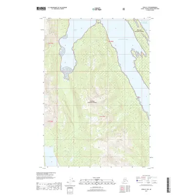
2017 Map of Sitka D-1 SW
USGS Topo · Published 2017About this map
Tongass National Forest dominates this coastal landscape, where the Admiralty Island wilderness meets the North Pacific. The terrain is defined by steep elevation changes and intricate water features, most notably Windfall Harbor at the northern reach and the expansive Hasselborg Lake to the south. This area serves as a primary example of the undisturbed temperate rainforest ecosystems of Southeast Alaska. Coastal navigation is anchored by Staunch Point, which overlooks the Gulf of Alaska. The map's grid, including t46s r69e and t47s r69e, reveals a land largely devoid of modern development, preserving the natural drainage patterns and dense vegetation characteristic of the Alexander Archipelago.
Find a feature on this map
9 named features on this map. Tap any name to fly to it.
Don’t see what you’re looking for? This feature index may not catch every label — zoom into the map to look around manually.
Map Details
Editions of this 2017 Sitka D-1 SW Map
This is the sole edition of this map. No revisions or reprints were ever made.
Other maps of this area

1948 · Sitka D-1
USGS Topo · 1:63,360

1948 · Sitka C-2
USGS Topo · 1:63,360

1948 · Sitka D-2
USGS Topo · 1:63,360

1948 · Sitka C-1
USGS Topo · 1:63,360

1951 · Sitka
USGS Topo · 1:250,000

1951 · Sitka D-1
USGS Topo · 1:63,360

1951 · Sitka C-1
USGS Topo · 1:63,360

1951 · Sitka D-2
USGS Topo · 1:63,360

1951 · Sitka C-2
USGS Topo · 1:63,360

1952 · Sitka
USGS Topo · 1:250,000