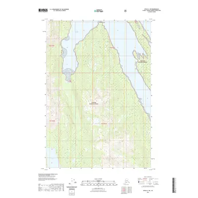
2021 Map of Sitka D-1 SW
USGS Topo · Published 2021About this map
Tongass National Forest dominates this coastal Alaska landscape, where dense forest meets the intricate waterways of the Alexander Archipelago. The survey illustrates the deep indentation of Windfall Harbor in the north and the northern reaches of Hasselborg Lake in the south, separated by a high, timbered interior. At the northernmost tip of the peninsula, Staunch Point serves as a critical maritime landmark for navigating the surrounding harbor. This 2021 update documents the wilderness character of the region, emphasizing the dramatic elevation changes and undisturbed coastline within the National Forest system.
Find a feature on this map
8 named features on this map. Tap any name to fly to it.
Don’t see what you’re looking for? This feature index may not catch every label — zoom into the map to look around manually.
Map Details
Editions of this 2021 Sitka D-1 SW Map
This is the sole edition of this map. No revisions or reprints were ever made.
Other maps of this area

1948 · Sitka D-1
USGS Topo · 1:63,360

1948 · Sitka C-2
USGS Topo · 1:63,360

1948 · Sitka D-2
USGS Topo · 1:63,360

1948 · Sitka C-1
USGS Topo · 1:63,360

1951 · Sitka
USGS Topo · 1:250,000

1951 · Sitka D-1
USGS Topo · 1:63,360

1951 · Sitka C-1
USGS Topo · 1:63,360

1951 · Sitka D-2
USGS Topo · 1:63,360

1951 · Sitka C-2
USGS Topo · 1:63,360

1952 · Sitka
USGS Topo · 1:250,000