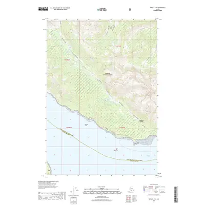
2017 Map of Sitka D-4 SW
USGS Topo · Published 2017About this map
Tenakee Springs anchors the shoreline of the Tenakee Inlet in this coastal Alaskan landscape within the Tongass National Forest. The settlement’s connectivity is defined by local thoroughfares like Tenakee Avenue and the Indian River Road, which traces the path of the Indian River as it winds through the interior. Notable maritime and navigational landmarks include Tenakee Reef and Grave Island, the latter of which contains the Grave Island Cem, a site of significant genealogical and local interest.
Find a feature on this map
23 named features on this map. Tap any name to fly to it.
Don’t see what you’re looking for? This feature index may not catch every label — zoom into the map to look around manually.
Map Details
Editions of this 2017 Sitka D-4 SW Map
This is the sole edition of this map. No revisions or reprints were ever made.
Other maps of this area

1948 · Sitka D-5
USGS Topo · 1:63,360

1948 · Sitka D-4
USGS Topo · 1:63,360

1951 · Sitka C-5
USGS Topo · 1:63,360

1951 · Sitka C-4
USGS Topo · 1:63,360

1951 · Sitka
USGS Topo · 1:250,000

1951 · Sitka D-5
USGS Topo · 1:63,360

1952 · Sitka
USGS Topo · 1:250,000

1955 · Sitka D-4
USGS Topo · 1:63,360

1964 · Sitka
USGS Topo · 1:250,000
1997 · Sitka D-4
USGS Topo · 1:63,360