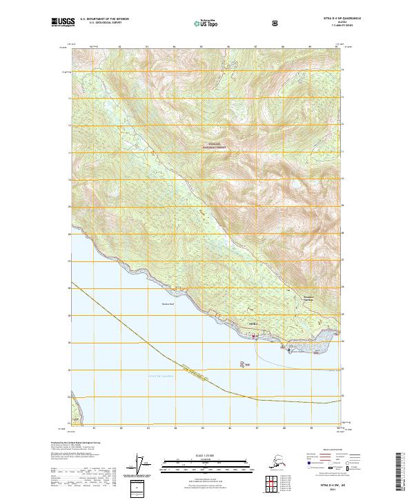
2021 Map of Sitka D-4 SW
USGS Topo · Published 2021About this map
Tenakee Springs sits along the northern shore of the Gulf of Alaska, centered on a network of shoreline paths including Tenakee Avenue and West Tenakee Avenue. This coastal settlement, located within the Tongass National Forest, is defined by its maritime orientation, where the land meets the water at Tenakee Reef. The map reveals a transition from the structured townsite to the surrounding wilderness, marked by the flow of the Indian River and the rugged inland topography of Hanging Valley.
Find a feature on this map
25 named features on this map. Tap any name to fly to it.
Don’t see what you’re looking for? This feature index may not catch every label — zoom into the map to look around manually.
Map Details
Editions of this 2021 Sitka D-4 SW Map
This is the sole edition of this map. No revisions or reprints were ever made.
Other maps of this area

1948 · Sitka D-5
USGS Topo · 1:63,360

1948 · Sitka D-4
USGS Topo · 1:63,360

1951 · Sitka C-5
USGS Topo · 1:63,360

1951 · Sitka C-4
USGS Topo · 1:63,360

1951 · Sitka
USGS Topo · 1:250,000

1951 · Sitka D-5
USGS Topo · 1:63,360

1952 · Sitka
USGS Topo · 1:250,000

1955 · Sitka D-4
USGS Topo · 1:63,360

1964 · Sitka
USGS Topo · 1:250,000
1997 · Sitka D-4
USGS Topo · 1:63,360