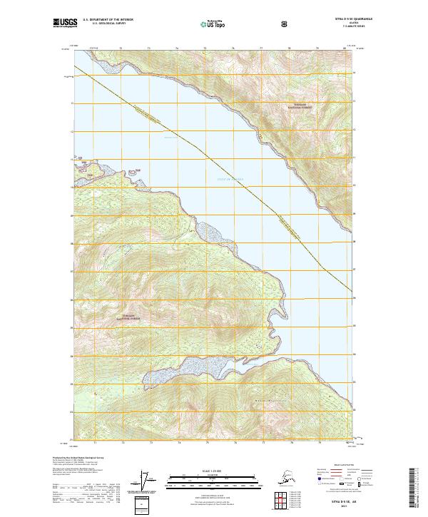
2021 Map of Sitka D-5 SE
USGS Topo · Published 2021About this map
Tenakee Inlet and the Gulf of Alaska dominate this maritime landscape along the boundary between the Hoonah-Angoon Census Area and Sitka City and Borough. The terrain is defined by the steep slopes of the Moore Mountains within the Tongass National Forest, where coastal drainages like Indian River and Inbetween Creek flow toward the sea. The map reveals a wild, coastal environment where the land meets the water at Saltery Bay, showing the intricate shoreline and elevation contours typical of the Alexander Archipelago. This modern survey tracks the precise municipal boundaries that divide these remote reaches of Southeast Alaska, providing a clear record of the intersection between federal forest lands and local borough jurisdictions.
Find a feature on this map
15 named features on this map. Tap any name to fly to it.
Don’t see what you’re looking for? This feature index may not catch every label — zoom into the map to look around manually.
Map Details
Editions of this 2021 Sitka D-5 SE Map
This is the sole edition of this map. No revisions or reprints were ever made.
Other maps of this area

1948 · Sitka D-5
USGS Topo · 1:63,360

1948 · Sitka D-4
USGS Topo · 1:63,360

1951 · Sitka C-5
USGS Topo · 1:63,360

1951 · Sitka C-4
USGS Topo · 1:63,360

1951 · Sitka
USGS Topo · 1:250,000

1951 · Sitka D-5
USGS Topo · 1:63,360

1952 · Sitka
USGS Topo · 1:250,000

1955 · Sitka D-4
USGS Topo · 1:63,360

1964 · Sitka
USGS Topo · 1:250,000
1997 · Sitka D-4
USGS Topo · 1:63,360