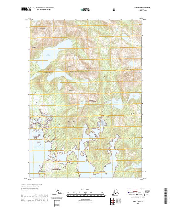
2021 Map of Sitka D-7 SW
USGS Topo · Published 2021About this map
Tongass National Forest dominates this coastal Alaskan landscape, where the Chichagof Island coastline is fragmented into a complex network of bays, harbors, and islands. The maritime geography is anchored by Mirror Harbor and Portlock Harbor, protected waters that have historically served as essential refuges for vessels navigating the outer coast. Significant elevations like Pinnacle Peak and Mine Mtn rise abruptly from the shoreline, while freshwater systems including the Stag River and the curiously named Goon Dip River drain the interior glacially-carved valleys. Human presence is marked by isolated footpaths such as Drypass Trl and Goulding Trl, indicating the limited overland access characteristic of this maritime wilderness. The distribution of named rocks and islands like Fairway Rock and Fleming Island highlights the navigational hazards along the entrance to Davison Bay.
Find a feature on this map
56 named features on this map. Tap any name to fly to it.
Don’t see what you’re looking for? This feature index may not catch every label — zoom into the map to look around manually.
Map Details
Editions of this 2021 Sitka D-7 SW Map
This is the sole edition of this map. No revisions or reprints were ever made.
Other maps of this area

1948 · Sitka C-7
USGS Topo · 1:63,360

1948 · Sitka D-8
USGS Topo · 1:63,360

1950 · Sitka D-8
USGS Topo · 1:63,360

1951 · Sitka D-7
USGS Topo · 1:63,360

1951 · Sitka
USGS Topo · 1:250,000

1951 · Sitka C-7
USGS Topo · 1:63,360

1952 · Sitka
USGS Topo · 1:250,000

1964 · Sitka
USGS Topo · 1:250,000
1994 · Sitka C-7
USGS Topo · 1:63,360
1995 · Sitka D-8
USGS Topo · 1:63,360