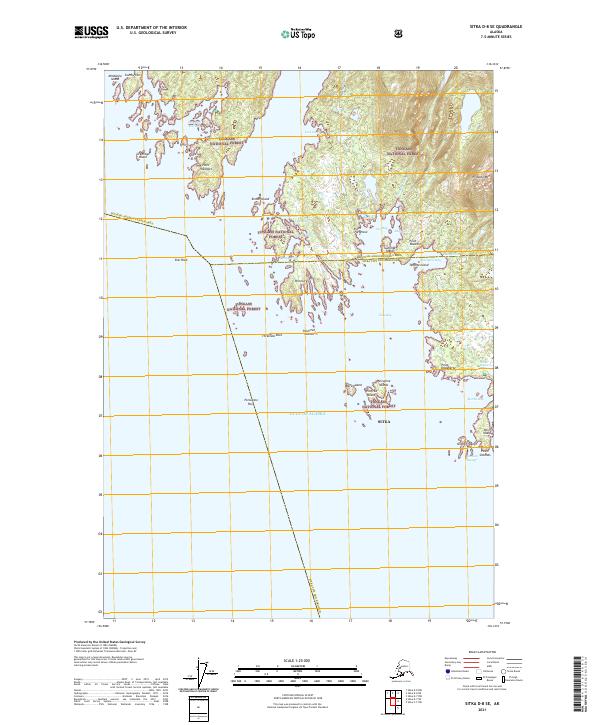
2021 Map of Sitka D-8 SE
USGS Topo · Published 2021About this map
The Tongass National Forest dominates this coastal landscape where the Gulf of Alaska meets a complex network of islands and inlets. The map illustrates a coastline defined by intricate waterways such as Canoe Pass and Canoe Slough, which separate landforms like Esther Island and Sushilna Island from the mainland. Historically significant maritime features including Greentop Harbor and Ilin Bay indicate the importance of sheltered waters for navigation in this region.
Find a feature on this map
45 named features on this map. Tap any name to fly to it.
Don’t see what you’re looking for? This feature index may not catch every label — zoom into the map to look around manually.
Map Details
Editions of this 2021 Sitka D-8 SE Map
This is the sole edition of this map. No revisions or reprints were ever made.
Other maps of this area

1948 · Sitka C-7
USGS Topo · 1:63,360

1948 · Sitka D-8
USGS Topo · 1:63,360

1950 · Sitka D-8
USGS Topo · 1:63,360

1951 · Sitka D-7
USGS Topo · 1:63,360

1951 · Sitka
USGS Topo · 1:250,000

1951 · Sitka C-7
USGS Topo · 1:63,360

1952 · Sitka
USGS Topo · 1:250,000

1964 · Sitka
USGS Topo · 1:250,000
1994 · Sitka C-7
USGS Topo · 1:63,360
1995 · Sitka D-8
USGS Topo · 1:63,360