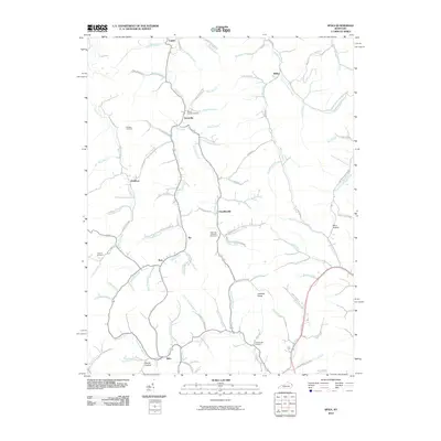
2010 Map of Sitka
USGS Topo · Published 2010About this map
Hood Creek and its many winding tributaries define the settlement patterns of this Johnson County landscape, where small communities are tucked into the narrow valleys. The map reveals a high density of family-named landmarks and burial grounds, such as the Marvin Sparks Cemetery and Wheeler Cemetery, reflecting deep-rooted generational ties to the land. From the northern hamlets of Tarklin and Wilbur down through Davisville and Chandlerville, the terrain is navigated by a network of creekside roads like Franks Creek Rd and Castle Fork Rd. A notable landmark, the Lettered Rocks, stands as a curious geographical feature east of Froginery Branch. The presence of scattered settlements like Sip, Kerz, and Sitka suggests a historical reliance on these waterway corridors for transport and community life before modern infrastructure expanded across the ridges.
Find a feature on this map
87 named features on this map. Tap any name to fly to it.
Don’t see what you’re looking for? This feature index may not catch every label — zoom into the map to look around manually.
Map Details
Editions of this 2010 Sitka Map
This is the sole edition of this map. No revisions or reprints were ever made.
Other maps of this area

1886 · Prestonsburg
USGS Topo · 1:125,000

1892 · Prestonsburg
USGS Topo · 1:125,000

1903 · Kenova
USGS Topo · 1:125,000

1904 · Kenova
USGS Topo · 1:125,000

1911 · Louisa
USGS Topo · 1:48,000

1913 · Louisa
USGS Topo · 1:62,500

1914 · Inez
USGS Topo · 1:48,000

1915 · Paintsville
USGS Topo · 1:48,000

1916 · Inez
USGS Topo · 1:62,500

1917 · Paintsville
USGS Topo · 1:62,500