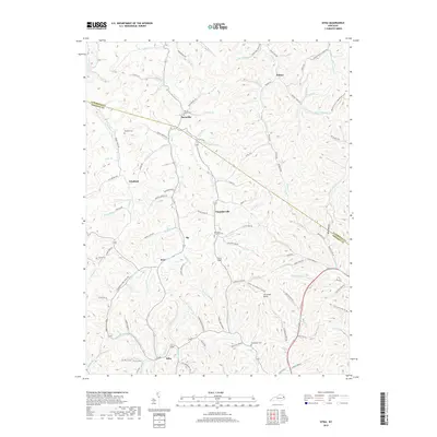
2019 Map of Sitka
USGS Topo · Published 2019About this map
Wilbur and Davisville anchor a network of valley settlements in this contemporary study of the eastern Kentucky hills. The landscape is defined by its deep hollows and narrow creek-side corridors, where small towns like Winifred, Chandlerville, and Sitka followed the natural drainage of Brushy Cr and Hood Cr. The concentration of family-named landmarks, such as Wheeler Cem and the Marvin Sparks Cem, points to generations of local residency in the high ridges between Johnson Co and Lawrence Co. In the south, the terrain descends toward Lettered Rocks and Burchett Hollow, while the complex hydrology of Rockhouse Fork and Castle Fork dictates the winding path of modern rural roads. This documentation of the late 2010s captures the enduring settlement patterns of the Cumberland Plateau before further shifts in the local rural economy.
Find a feature on this map
111 named features on this map. Tap any name to fly to it.
Don’t see what you’re looking for? This feature index may not catch every label — zoom into the map to look around manually.
Map Details
Editions of this 2019 Sitka Map
This is the sole edition of this map. No revisions or reprints were ever made.
Other maps of this area

1886 · Prestonsburg
USGS Topo · 1:125,000

1892 · Prestonsburg
USGS Topo · 1:125,000

1903 · Kenova
USGS Topo · 1:125,000

1904 · Kenova
USGS Topo · 1:125,000

1911 · Louisa
USGS Topo · 1:48,000

1913 · Louisa
USGS Topo · 1:62,500

1914 · Inez
USGS Topo · 1:48,000

1915 · Paintsville
USGS Topo · 1:48,000

1916 · Inez
USGS Topo · 1:62,500

1917 · Paintsville
USGS Topo · 1:62,500