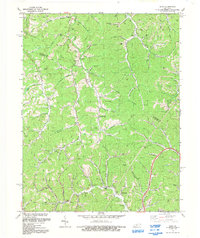
1992 Map of Sitka
USGS Topo · Published 1992About this map
Sitka and Stambaugh sit at the southern edge of this East Kentucky landscape, where the ridge-and-hollow terrain of Johnson and Lawrence counties is defined by an extensive network of natural gas and oil extraction. Numerous Gas Wells and Drill Holes are scattered across the timbered slopes above Mudlick Creek, Brushy Creek, and the Left Fork Blaine Creek. These industrial markers share the land with older community anchors, such as the Hoods Fk Ch and Enterprise Ch, alongside family burial grounds like Sparks Cem and the Wheeler Cem. The map illustrates a region where local geography is deeply personal, featuring distinct landmarks like the Lettered Rocks and the Lookout Tower near the western border. The intricate branching of waterways, including Georges Creek and Rockhouse Fork, underscores the historical reliance on these narrow valleys for both transport and settlement in the late twentieth century.
Find a feature on this map
60 named features on this map. Tap any name to fly to it.
Don’t see what you’re looking for? This feature index may not catch every label — zoom into the map to look around manually.
Map Details
Editions of this 1992 Sitka Map
This is the sole edition of this map. No revisions or reprints were ever made.
Other maps of this area

1886 · Prestonsburg
USGS Topo · 1:125,000

1892 · Prestonsburg
USGS Topo · 1:125,000

1903 · Kenova
USGS Topo · 1:125,000

1904 · Kenova
USGS Topo · 1:125,000

1911 · Louisa
USGS Topo · 1:48,000

1913 · Louisa
USGS Topo · 1:62,500

1914 · Inez
USGS Topo · 1:48,000

1915 · Paintsville
USGS Topo · 1:48,000

1916 · Inez
USGS Topo · 1:62,500

1917 · Paintsville
USGS Topo · 1:62,500