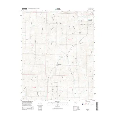
2014 Map of Sitka
USGS Topo · Published 2014About this map
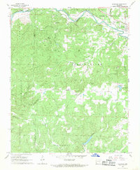
The settlement of Sitka serves as the central hub of this Sharp County landscape, situated at the junction of Ar-58 and several winding rural roads. The terrain is defined by a dense network of hollows and ridges, such as Hickory Ridge and Gann Hill, which dictate the local drainage patterns into Mill Cr and Hurricane Cr. Along the northern edge, the Spring River carves a prominent path beneath Hurricane Bluff, where Spring River Ranch Rd provides access to the waterfront. Family and community history is preserved in several localized burial grounds, including Schales Cem and Hopewell Cem. The map reveals a rural economy shaped by topographic constraints, with homesteads and structures following the contours of the land, particularly near Divide Hill and Low Gap. This 2014 survey documents the persistence of small-scale agriculture and timber-related land use in the Ozark foothills.
Find a feature on this map
82 named features on this map. Tap any name to fly to it.
Don’t see what you’re looking for? This feature index may not catch every label — zoom into the map to look around manually.
Map Details
Editions of this 2014 Sitka Map
This is the sole edition of this map. No revisions or reprints were ever made.
Other maps of this area

1957 · Poplar Bluff
USGS Topo · 1:250,000

1959 · Poplar Bluff
USGS Topo · 1:250,000

1960 · Poplar Bluff
USGS Topo · 1:250,000
1961 · Evening Shade
USGS Topo · 1:24,000

1962 · Stuart
USGS Topo · 1:24,000

1962 · Ash Flat
USGS Topo · 1:24,000
1965 · Poughkeepsie
USGS Topo · 1:24,000
1965 · Smithville
USGS Topo · 1:24,000

1968 · Hardy
USGS Topo · 1:24,000
1968 · Ravenden
USGS Topo · 1:24,000